Iceland earthquakes history tells one of the most unusual seismic stories on Earth. Iceland lies on the Mid-Atlantic Ridge and above a mantle hotspot, combining crustal rifting, transform faulting, volcanism and frequent earthquake swarms.
Most earthquakes recorded in Iceland are small, but the historical record shows that tectonic zones such as the South Iceland Seismic Zone (SISZ) and the Tjörnes Fracture Zone are capable of producing damaging earthquakes that are not necessarily linked directly to an eruption.
This timeline reviews several of Iceland’s most important earthquakes, their estimated or instrumental magnitudes, impacts and scientific lessons. For current activity, EarthSentra maintains a separate page for earthquakes in Iceland today.
Why Iceland has so many earthquakes
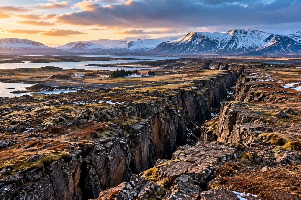
Iceland straddles the boundary between the North American and Eurasian plates. Along volcanic zones the crust is pulled apart, while motion between offset rift segments is transferred through shear zones and strike-slip faults.
The South Iceland Seismic Zone connects major volcanic-zone segments. It contains numerous approximately north-south strike-slip faults, and historical evidence shows that earthquakes in this region can approach magnitude 7.
In northern Iceland, the Tjörnes Fracture Zone performs a similar tectonic role. On the Reykjanes Peninsula, rifting, faulting and magma movement can interact, producing especially complex earthquake sequences.
Iceland earthquakes history: timeline of major events
1784 — The largest known historical earthquake in the SISZ
On 14 August 1784, one of the strongest documented earthquakes in southern Iceland occurred. Later scientific studies estimate its magnitude at approximately M7.1, making it the largest known SISZ event of the past three centuries.
Because it predates modern instruments, its magnitude was reconstructed from historical records, the distribution of damage and the size of the affected area.
Date: 14 August 1784
Estimated magnitude: M7.1
Region: South Iceland / SISZ
Significance: largest estimated SISZ earthquake in roughly three centuries.
1896 — Five large earthquakes in 12 days
Between 26 August and 6 September 1896, southern Iceland experienced an extraordinary sequence of five large earthquakes.
The sequence caused widespread damage in rural South Iceland and became a key example of how faults within the SISZ can activate in rapid succession.
For modern hazard science, the 1896 sequence remains important because it demonstrates how a large earthquake can redistribute stress onto nearby faults, allowing other major events to follow within days.
1912 — The Selsund earthquake, about M7.0
On 6 May 1912, another major earthquake struck the eastern margin of the South Iceland Seismic Zone. Its magnitude is estimated at approximately M7.0.
Surface ruptures associated with the earthquake were later mapped in detail and continue to provide evidence of the tectonic deformation taking place across the region.
Date: 6 May 1912
Estimated magnitude: M7.0
Region: eastern SISZ
Significance: one of Iceland’s largest historical earthquakes and an important early instrumental-era event.
1929 and 1968 — Significant earthquakes on Reykjanes
The Reykjanes Peninsula has also produced strong tectonic earthquakes. Scientific records describe an event of about M6 on 23 July 1929, probably near Hvalhnúkur.
Another earthquake occurred in the same broad region on 5 December 1968, with an estimated magnitude between M5.4 and M6.
These events show that Iceland’s seismic hazard is not confined to the South Iceland lowland. Reykjanes combines rifting, strike-slip faulting and magmatic processes, and individual earthquake sequences may involve more than one mechanism.
1987 — Vatnafjöll, Mw5.9
In 1987, an approximately Mw5.9 earthquake occurred near Vatnafjöll at the eastern edge of the South Iceland seismic region. Research interpreted it as a strike-slip earthquake without a direct connection to magmatic activity.
The event is a useful reminder that even in a highly volcanic country, many significant earthquakes are primarily tectonic.
2000 — Two major earthquakes 3.5 days apart
The June 2000 sequence became a landmark for modern Icelandic seismology.
A major earthquake struck South Iceland on 17 June 2000. Only 3.5 days later, on 21 June, another event of about Mw6.5 ruptured a different fault.
Unlike the great historical earthquakes, the 2000 sequence was recorded by a modern seismic network. Scientists could follow microearthquakes, fault activation and changes in crustal stress in unprecedented detail.
The sequence demonstrated how one large earthquake can alter stresses on neighboring faults and helped drive international research into earthquake hazards and precursory crustal processes.
2008 — The Ölfus earthquake and a seismic doublet
On 29 May 2008, a strong earthquake struck southwest Iceland near Ölfus and Selfoss. The Icelandic Meteorological Office initially reported a magnitude of 6.1; later scientific work described the episode as a doublet of roughly Mw6 earthquakes on nearby faults separated by only seconds.
The shaking caused building and infrastructure damage and led to temporary bridge closures for safety inspections.
GPS measurements documented permanent crustal displacement after the earthquake: about 20 centimeters of horizontal movement near Selfoss and about 17 centimeters near Hveragerði in the opposite direction.
Date: 29 May 2008
Magnitude: about M6.1 / doublet near Mw6
Region: Ölfus, southwest Iceland
Main impact: structural damage, infrastructure inspections and measurable permanent crustal deformation.
Comparison of major earthquakes in Iceland
| Year | Region | Magnitude | Main feature |
|---|---|---|---|
| 1784 | South Iceland | Estimated M7.1 | Largest estimated historical SISZ event |
| 1896 | South Iceland | Large sequence | Five major earthquakes in 12 days |
| 1912 | Selsund / eastern SISZ | Estimated M7.0 | Major tectonic rupture and surface faulting |
| 1929 | Reykjanes | ~M6 | Significant peninsula earthquake |
| 1968 | Reykjanes | M5.4–6 | Another strong regional event |
| 1987 | Vatnafjöll | Mw5.9 | Strike-slip event not directly magmatic |
| 2000 | South Iceland | ~M6.5 | Two large earthquakes 3.5 days apart |
| 2008 | Ölfus | ~M6.1 | Seismic doublet and GPS-measured deformation |
Magnitude, intensity and damage tell different stories
Magnitude measures the physical size of an earthquake, while intensity describes how strongly it is felt and what effects it produces at a particular location. One earthquake can generate very different intensities depending on distance, local geology and building vulnerability.
For Iceland’s pre-instrumental earthquakes, magnitudes are reconstructed from historical accounts, damage patterns, surface ruptures and the geographic extent of effects. Estimates for events such as 1784, 1896 and 1912 can therefore vary slightly between studies.
What changed after Iceland’s major earthquakes
Iceland’s major earthquakes accelerated improvements in monitoring, engineering and hazard assessment.
For decades, the SIL network allowed scientists to detect and analyze very small earthquakes. In February 2026, the Icelandic Meteorological Office formally made SeisComP its primary earthquake monitoring and analysis system, while SIL continued as a secondary system during the transition.
Modern monitoring combines seismometers, GPS, InSAR and fault mapping. These tools can identify where stress is building and document how the crust deforms, but they do not allow scientists to predict the exact date and time of a major earthquake.
What we know today about Iceland’s seismic risk
History shows that damaging earthquakes tend to cluster in well-known tectonic regions, especially the SISZ, Reykjanes and northern Iceland.
Actual risk depends on more than magnitude. Depth, distance to communities, ground conditions, building vulnerability and infrastructure all influence the final impact.
Recent volcanic unrest has increased public attention on Icelandic earthquakes, but the distinction remains important: a seismic sequence can be driven by magma movement, tectonic faulting, or a combination of both.
History and current activity serve different purposes
This article explains Iceland’s seismic past and the lessons left by major earthquakes. It deliberately does not reproduce the live map or recent-event list.
To see what is happening now, visit Earthquakes in Iceland Today: Latest Quakes and Magnitudes, where EarthSentra displays recent activity using automatically updated monitoring data.
Historical and scientific sources
- Icelandic Meteorological Office — reports and publications on Icelandic seismicity.
- Icelandic Meteorological Office — 29 May 2008 earthquake.
- Icelandic Meteorological Office — crustal deformation after the 2008 earthquake.
- Icelandic Meteorological Office — South Iceland seismic zone and historical M7 earthquakes.
- Institute of Earth Sciences, University of Iceland — crustal processes and earthquake research.